

Vulnerability Analysis
The Corn Neck Road project area, spanning from Old Harbor to Scotch Beach Road in New Shoreham on Block Island, faces increasing threats from erosion, rising sea levels, and storm events. This project was undertaken to assess vulnerabilities within this critical corridor and support long-term resilience planning.
A comprehensive site assessment was conducted, incorporating publicly available data alongside advanced surveying techniques such as RTK and LiDAR. These high-resolution topographic methodologies provided essential insights into existing conditions and potential areas of concern.
The findings of this Site Vulnerability Assessment will serve as a foundation for subsequent master planning and design efforts. A range of nature-based restoration strategies will be explored and evaluated to mitigate risks and enhance environmental sustainability. Additionally, the analysis will guide engagement with project stakeholders, informing future decision-making processes.
The primary vulnerable areas of concern within the project area are identified based on near-term and long-term issues. These include:
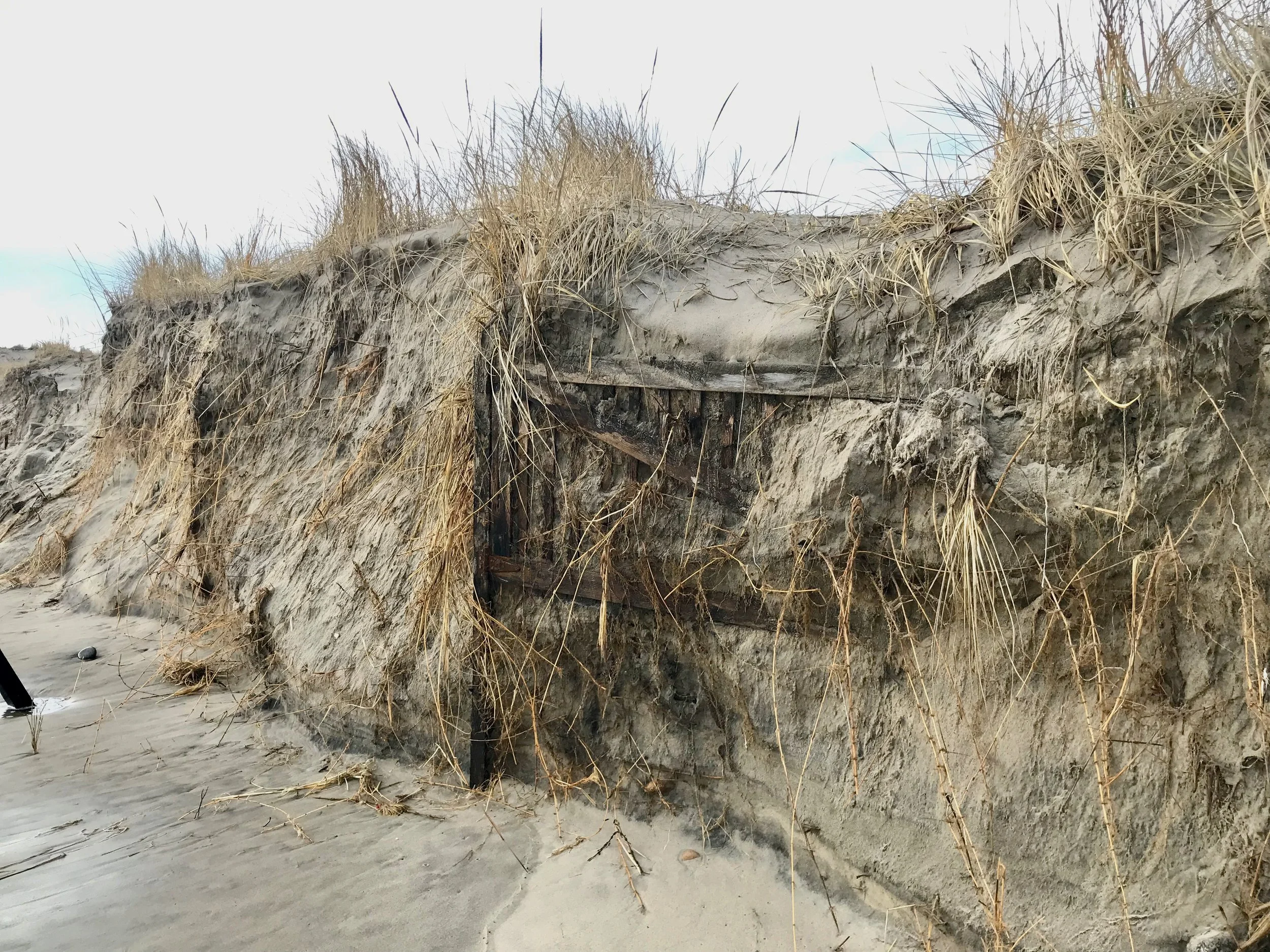
Dune System - The barrier beach and dune system along the Site are situated on a narrow strip of land between the Great Salt Pond (New Harbor) and the Atlantic Ocean, and its width is becoming narrower. This introduces the risk of future inundation of the land during coastal storms, permanent loss of dune, and potential damage to Corn Neck Road.
Scotch Beach Road – This beach parking area is low lying, and prone to flooding, both from roadway runoff during heavy precipitation events and from groundwater intrusion and wave overtopping during significant coastal storm events. The dune at the seaward end of the beach access path has experienced considerable erosion due to pedestrian and vehicular traffic, reducing its effectiveness in protecting against wave runup.
The Town Beach Parking Area – Corn Neck Road is sloped eastward, toward the parking areas, with a low area at the southern lot. This topographical configuration, combined with the low-lying nature of the lot, creates susceptibility to pooling water during precipitation events.
Coastal Revetment – The stone revetment along the southern section of Corn Neck Road is located along a roadway section of high elevation, but the revetment is steep and exposed to daily tidal inundation and waves. This high exposure may cause a stability failure during a storm event, and with it directly abutting Corn Neck Road, it will likely cause roadway damage if it fails. Further the sand on top of the revetment is mostly sacrificial and can be eroded during storm events.
Vulnerable Areas
-

Town Beach Parking Lots
The Town Beach parking areas, particularly the South parking area has flooding more frequently from smaller precipitation events. The primary source of flooding is due to rainwater roadway runoff that sheds to the East on Corn Neck Road into the South parking area. Further, the concrete pad between the North and South lots blocks water flow from the North to South lot, flooding the southern edge of the North lot until the water is high enough to overtop the pad and flow to the South lot. These features create standing water during precipitation events.
-

Town Beach Pavilion (Beach House)
The Town Beach Pavillion is vulnerable to coastal storm events because of its location, in line with the dunes and where dunes would likely be if the pavilion wasn’t built. Both the North and South sides of the pavilion also have had the dunes removed for public and emergency access to the beach. The Town Beach parking areas have flooded during large coastal storm events from wave runup and overtopping under and around the Town beach Pavillion, where dunes have been removed.
-

Scotch Beach Road
Scotch Beach Road contains a low-lying parking area just East of Corn Neck Road and a mixed sand and cobble path for walking and public driving access to the beach. The parking area is vulnerable to surface water runoff from the roadway during precipitation events. The parking area and road are also vulnerable to wave overwash from the beach, running down the access pathway during large storm events. Flooding is increased due to the area’s low elevation and near-surface groundwater and groundwater mounding, particularly as sea levels rise.
-
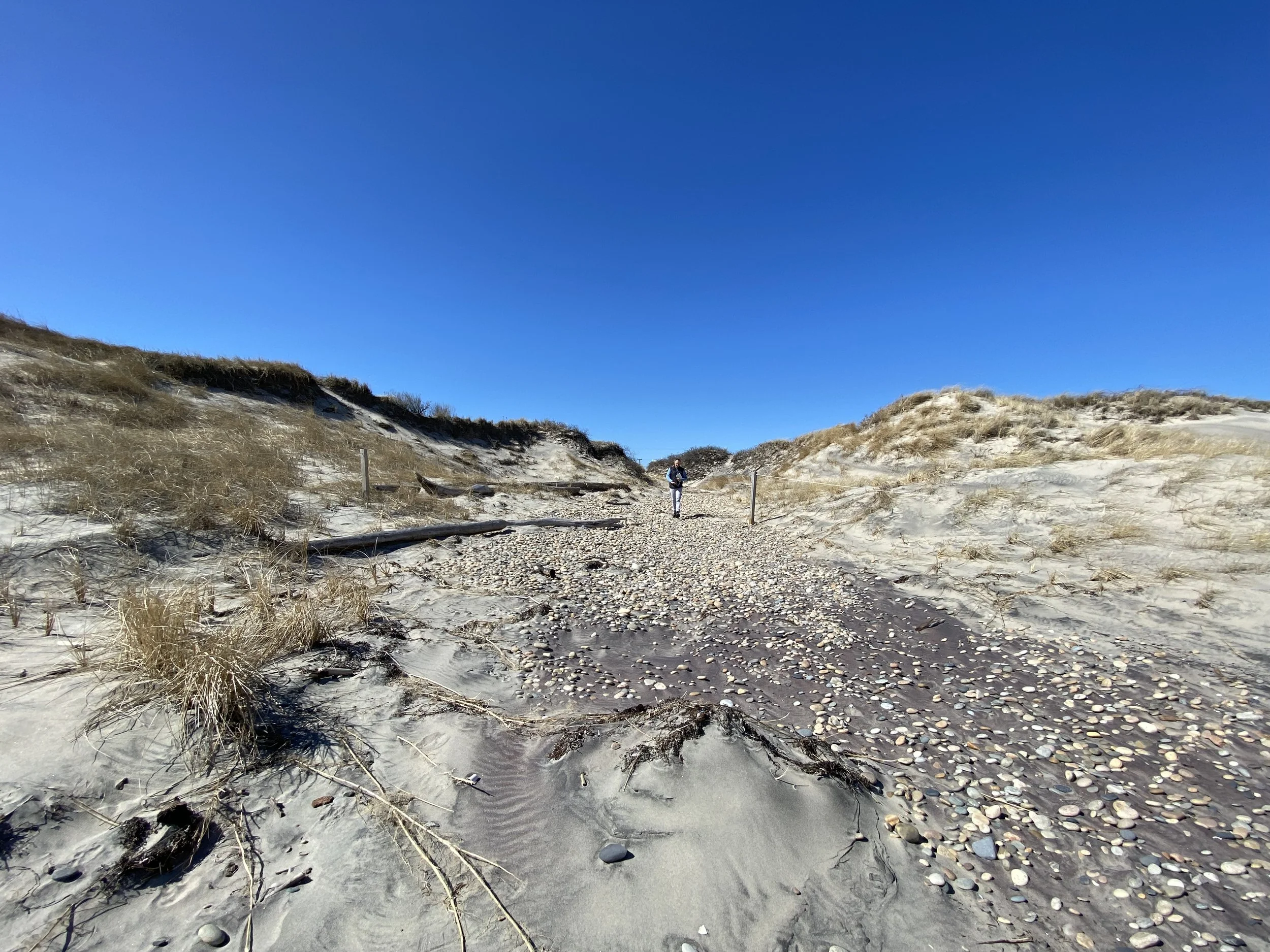
Dune Beach Paths
Dune beach access pathways have damages from a combination of pedestrian foot, car, and cart traffic as well as coastal erosion due to storm events. Pedestrian damage of the dune system is primarily caused by flattening and moving sand and stepping on young plants trying to establish and stabilize the dunes. This is particularly pronounced on the seaward edge of the dunes where pedestrians “fan out” to access various areas of the beach, widening the openings on the seaward side, and reducing dune height and limiting vegetation growth. The dune heights make the dunes more vulnerable to overtopping and overwash from large coastal storm events.
-

Revetment
The coastal revetment along the southern end of Corn Neck Road is located within feet of the edge of the roadway, is very steep, and has a toe that is submerged daily due to normal high tides, leaving the revetment susceptible to damage from wave action. The steepness of the revetment increases its vulnerability to a stability failure during a coastal storm event, which could then, due to its proximity, damage or undermine the roadway. Smaller armor stones mixed throughout the revetment could also shift during smaller storm events, which may lead to larger failures.
-

Marsh
Marsh, along the western edge of the roadway is vulnerable under projected sea level rise scenarios and indicates a consistent pattern of landward marsh migration. This landward shift will likely result in marsh loss at the seaward boundary and expansion landward into adjacent upland areas, bordering the roadway. Hardened shorelines, such as Corn Neck Road limit the landward movement. Further, sea level rise will induce mortality in less salt-tolerant vegetation, resulting in marsh encroachment on the western side of Corn Neck Road, and potentially reducing the debris obstruction larger shrubs have on shielding the roadway following significant coastal flooding.